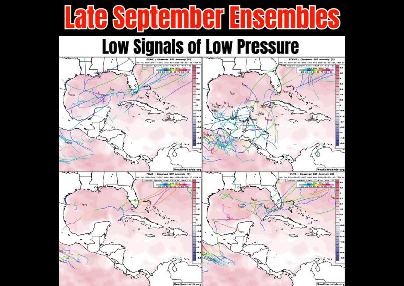
GULF OF MEXICO — Meteorologists are keeping a close watch on the tropics as late September ensemble weather models display early signals of lowering pressures across parts of Central America and the surrounding waters. Historical patterns for this time of year support the possibility of continued tropical activity, though current model output remains inconsistent, with several forecasting systems producing differing interpretations of the same atmospheric setup. No organized tropical system has developed at this time, and meteorologists caution that confidence in any specific outcome remains low.
Mixed Signals Across Major Forecast Models
A review of several leading ensemble forecasting systems reveals a divided picture heading into the final days of September. Some models, including the European ensemble, show stronger indications of a low-pressure system organizing in the Caribbean and Gulf of Mexico region, while others, including AI-driven forecasting tools, show weaker or negligible signals for the same timeframe and area. This kind of model disagreement is common at extended ranges and typically narrows as a potential system approaches, if one develops at all.
Historical Pattern Supports Continued Watch
Late September has historically been an active window for tropical development in the Caribbean and Gulf of Mexico, as water temperatures remain warm enough to support organization even as the broader hurricane season begins its seasonal decline. Some model guidance also points to potential moisture and energy crossover from disturbances in the eastern Pacific, which can occasionally interact with or influence developing systems on the Atlantic side. Forecasters emphasize that this seasonal pattern alone does not guarantee development, only that conditions remain worth monitoring.
No Immediate Threat Identified
At this stage, there is nothing solid enough in the data to warrant elevated concern for any specific coastline or region. Meteorologists stress that the current signals are exploratory rather than predictive, reflecting the kind of long-range uncertainty typical of extended-range ensemble modeling. Residents along the Gulf Coast and in Central America are not currently facing any defined tropical threat, though the pattern will continue to be monitored closely as the calendar moves toward the final days of the month.
Outlook Heading Into Early October
Forecasters plan to continue tracking the ensemble trends in the coming days as models typically gain clarity closer to any potential development window. Should a more organized signal emerge, additional model agreement would be needed before any formal tropical outlook or advisory could be issued. For now, the situation remains a watch-and-wait scenario, with meteorologists monitoring pressure trends and model consistency across the Gulf of Mexico, Caribbean, and Central America through the remainder of September.